
Looking for the best hikes in Albuquerque? Here are three solid options, from a serious climb to shorter hikes that deliver.
Last Updated: April 2026
As someone who’s lived in the Albuquerque area for over 20 years, and logged more trail miles than I probably should admit, I get asked the same question all the time:
What are the best hikes in Albuquerque?
The honest answer is “it depends.” Annoying, I know. But true.
It really comes down to what you’re looking for. A long, leg-burning climb? Something quick and scenic? A trail you can knock out before lunch and still feel like you earned your green chile cheeseburger?
So here are three solid options based on different activity levels, plus my personal favorite that works for just about everyone.
Quick Picks: The 3 Best Hikes in Albuquerque
- Best for a challenge: La Luz Trail
- Best for flexible hiking options: Elena Gallegos Open Space
- Best overall (my pick): Tree Spring Trail
These are my three go-to hikes, with Tree Spring being the one I personally come back to most often.
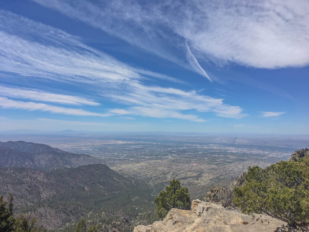
Table of Contents
Heads up: Some of the links in this post are affiliate links. If you buy something through them, it helps support this site, at no extra cost to you. I only recommend stuff I genuinely use and trust.
The Classic Grind (but a beautiful one): La Luz Trail and Its 3,200-Foot Climb
This one rarely surprises anyone. La Luz is Albuquerque’s flagship hike. It’s 7.5 miles one way, with a leg-burning 3,200-foot climb to the top of Sandia Peak. It’s tough, it’s beautiful, and it’s absolutely worth the effort.
For those who thought hiking La Luz wasn’t quite painful enough, there used to be the annual La Luz Trail Run. I’ve done it multiple times and lived to tell the tale. The race stretched 9 miles and climbed over 4,000 feet, starting farther down the road to give runners space before funneling onto the trail. It sold out every year, with a lottery system for one of the 400 coveted spots permitted by the U.S. Forest Service. Sadly, the race ended in 2021 when Cibola National Forest decided not to renew the permit. A tough loss for mountain masochists everywhere.
Fortunately, La Luz is still a great hike, and you can run it if you want to.
Here’s a link to learn more about La Luz Trail. Unless you have an annual pass, parking is $5 at the La Luz Trailhead, cash or check only.
If hiking just one direction, either up or down, sounds more appealing than doing the full round trip, you’re in luck. The Sandia Peak Aerial Tramway makes that possible. Check out my post about the Sandia Peak Tramway for tips on how to use it to knock out one leg of your hike. The tram base and the La Luz trailhead aren’t exactly next door, so if you’re doing a one-way hike, it’s closer to 9 miles instead of 7.5. That extra distance comes from a connector trail between the tram base and the La Luz trailhead. Unless you park two cars, plan on the longer route, or convince a friend to pick you up and shuttle you back to your car.

A Flexible Option: Elena Gallegos for Short or Long Hikes
If you’re looking for something more accessible, Elena Gallegos Open Space is a local favorite that offers a little bit of everything, including easy loops, moderate routes, and more challenging options like the Pino Trail. The Pino Trail is a 9.2-mile out-and-back climb (4.6 miles each way) up to a saddle on Sandia Peak, and it’s probably my second or third favorite hike in Albuquerque. It tends to trade places with La Luz depending on how my legs feel that day.
Elena Gallegos is also one of my go-to spots in winter. The lower foothills tend to be warmer, and the sun clears out snow more quickly in the open areas. Once you get into the trees, the snow tends to stick around, so I usually stick to the lower elevations this time of year.
Whether you’re hiking, mountain biking, or just out for a scenic stroll, Elena Gallegos Open Space is one of the best all-around outdoor spots in the Albuquerque area.
The entrance fee is $1 per vehicle Monday through Friday, and $2 per vehicle on weekends.


My Go-To Hike: Tree Spring Trail on the East Side of the Sandias
Now let’s talk about the hike I always recommend for those looking for something short, scenic, and worth the drive: Tree Spring Trail.
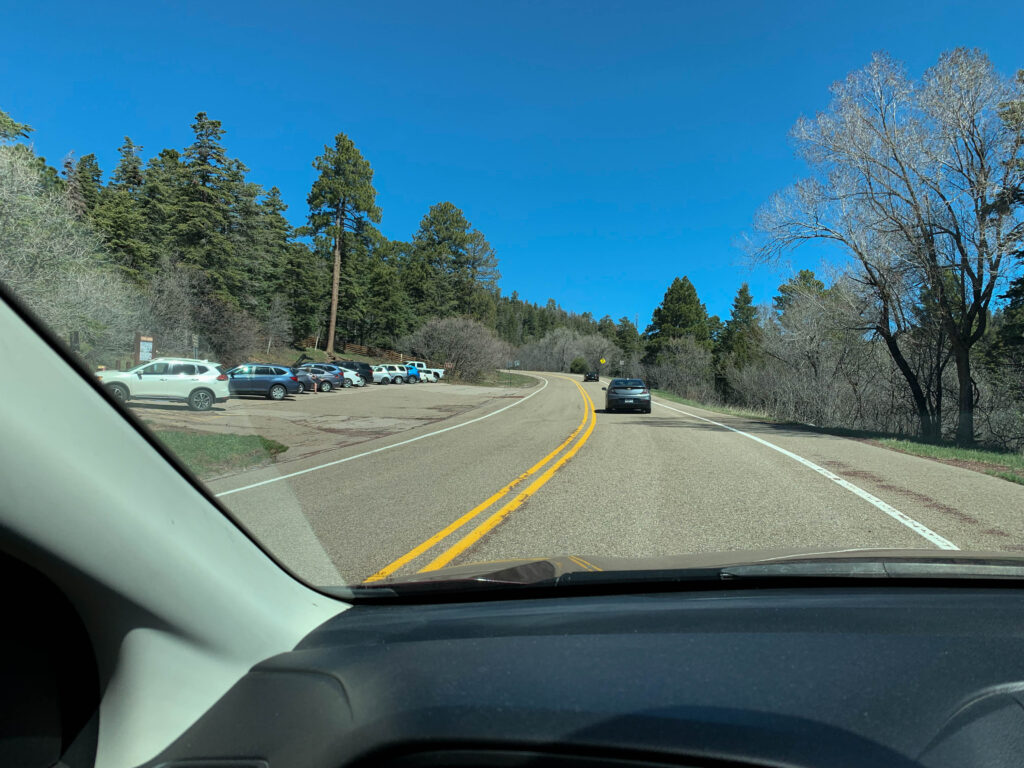
Located on the east side of the Sandia Mountains, Tree Spring is part of what locals call the East Mountains. If you’re in Albuquerque, you’ll need to hop on I-40 East and drive about 35 minutes to reach the trailhead, but it’s worth it.
Getting There: How to Find the Tree Spring Trailhead (Before You Lose Cell Service)
- Take I-40 East from Albuquerque.
- Exit at 175 toward Cedar Crest / NM-14.
- Drive 6.5 miles north on NM-14 to the roundabout at NM-536, also known as the Sandia Crest Scenic Byway.
- At the roundabout, turn left onto NM-536 (towards the mountains) and follow it for 5.5 miles until you see the Tree Spring parking lot on your left.
You’ll pass a Shell gas station and the Lazy Lizard Grill at the roundabout. It’s a solid post-hike stop for pizza, a cold drink, and sometimes live music if you time it right.
One more thing: cell service starts to get spotty as you head up NM-536, so take care of any last-minute navigation before you head into the mountains.
What to Know Before You Go: Passes, Pit Stops, and Picnic Tables
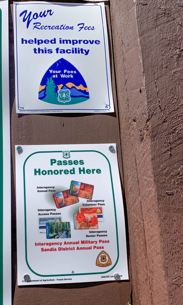
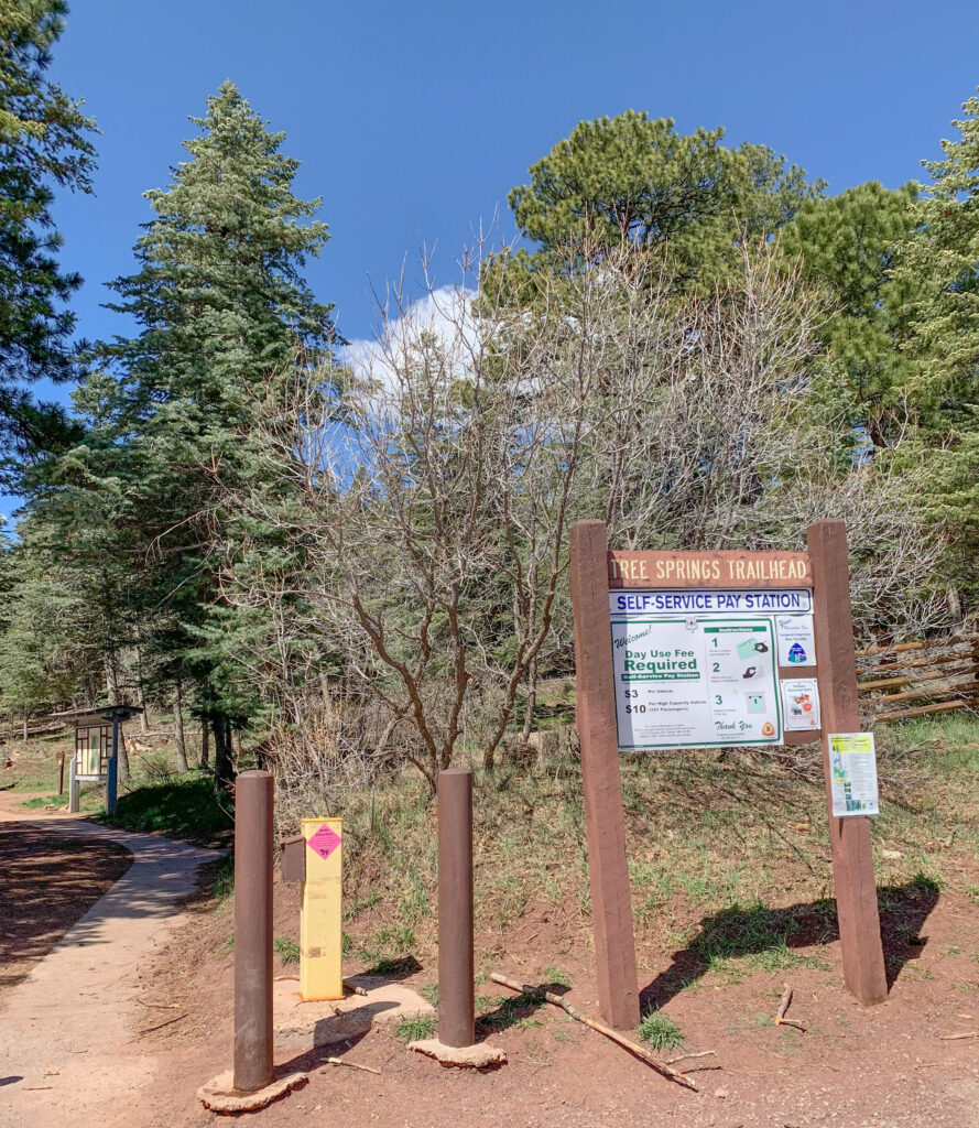
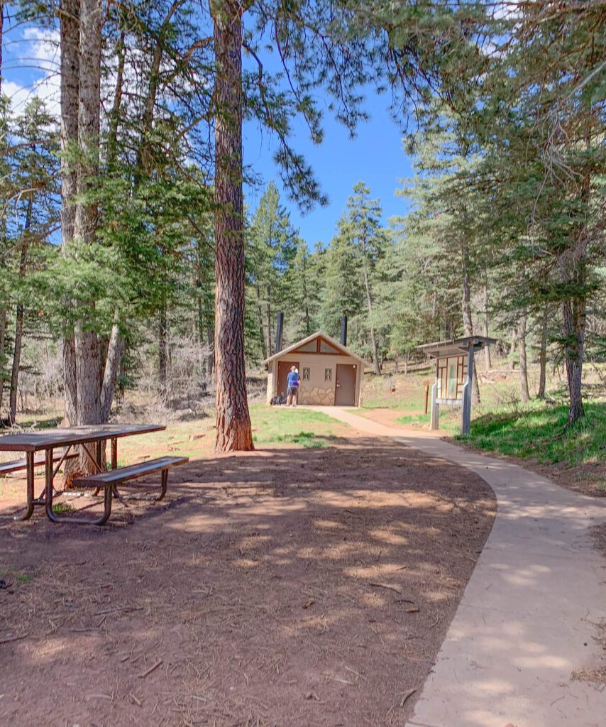
Parking is $5 per vehicle at the trailhead. It’s a self-service pay station, cash or check only.
So bring exact change, preferably dollar bills if you’re paying cash. Too many coins and your envelope won’t fit in the slot, which is probably not how you want to start your hike.
Annual passes, including the New Mexico Enchantment Pass and Interagency Passes, are also accepted here. If you don’t have one but want to join the club, you’ll need to swing by the Sandia Ranger District office in Tijeras during business hours to pick one up.
You’ll also find picnic tables and a restroom (pit toilet) at the trailhead. It’s a good spot to get organized before you start hiking.
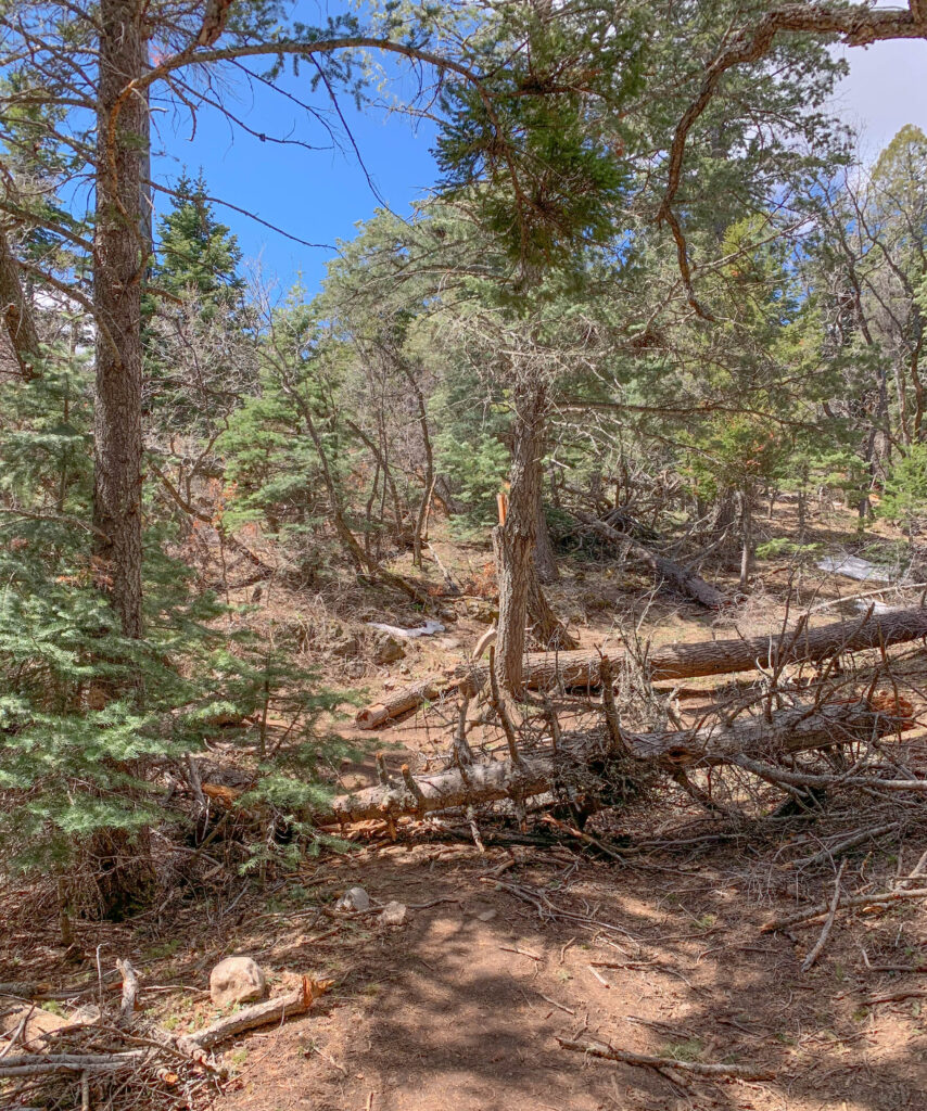
On the Trail: Pines, Alpacas, and a Surprisingly Good Workout
Part of the trail is multi-use, so you may run into hikers, mountain bikers, horseback riders, and yes, I’ve even seen alpacas. Once.
Dogs are allowed but must be on a leash.
In winter, the shaded sections of the trail can become very icy, and you may see a few snowshoers out there. Where there’s snow and ice, there’ll be mud in the spring, so plan accordingly.
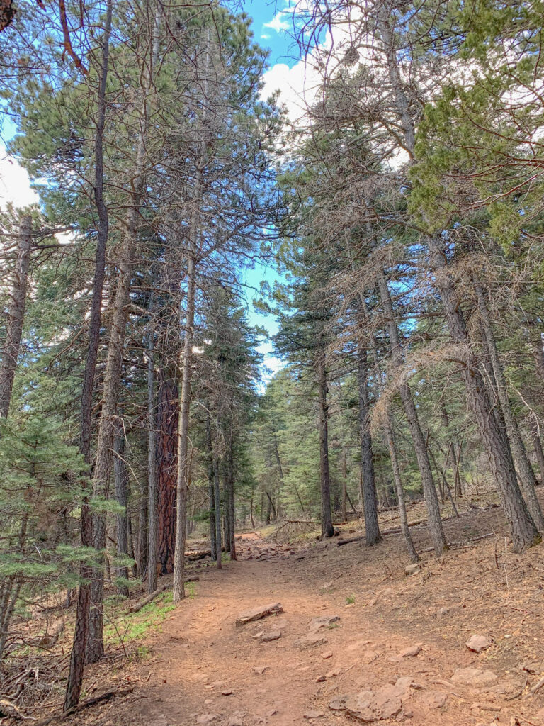
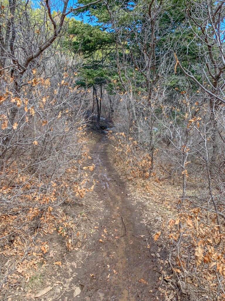
Tree Spring Trail starts at an elevation of 8,470 feet and climbs to 9,440 feet, which means you’ll trade scorching temperatures for cooler mountain air, shady stretches of forest, and, depending on the season, a little snow or mud to keep things interesting. In summer, it’s smooth sailing. The trail is well-marked, easy to follow, and a great introduction to higher-elevation hiking in the Sandias.
But in winter, it’s a different story. Snow can blanket the trail entirely, turning a casual hike into an unintentional game of “where’s the path?” Many trees are tagged with helpful blue blazes to keep you on course, but a fresh snowfall can bury the clues, along with the footprints of anyone who came before you. So bring your sense of direction, a good layer, and a healthy respect for the mountain’s ability to humble even the most confident hikers.
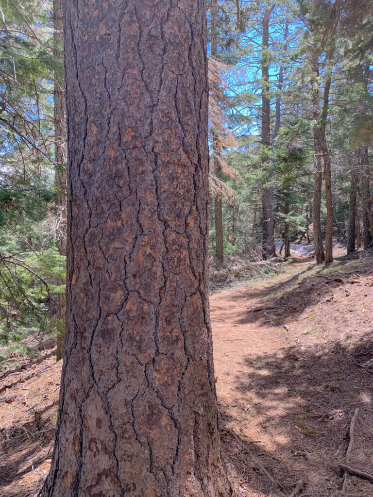
You’ll pass through stands of ponderosa pine (yes, the bark really does smell like vanilla) and enjoy some scenic overlooks as you gain elevation.
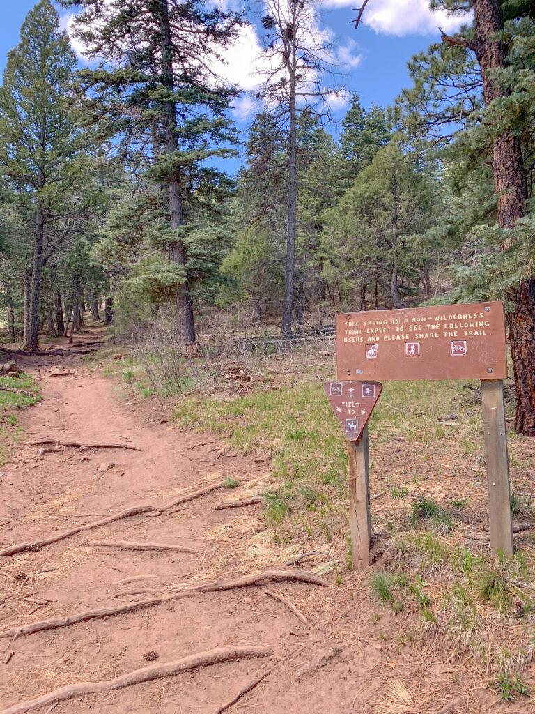
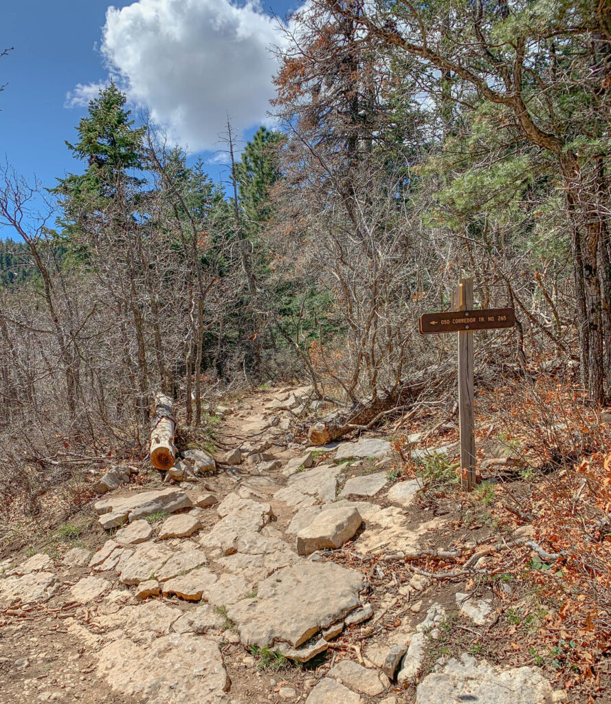
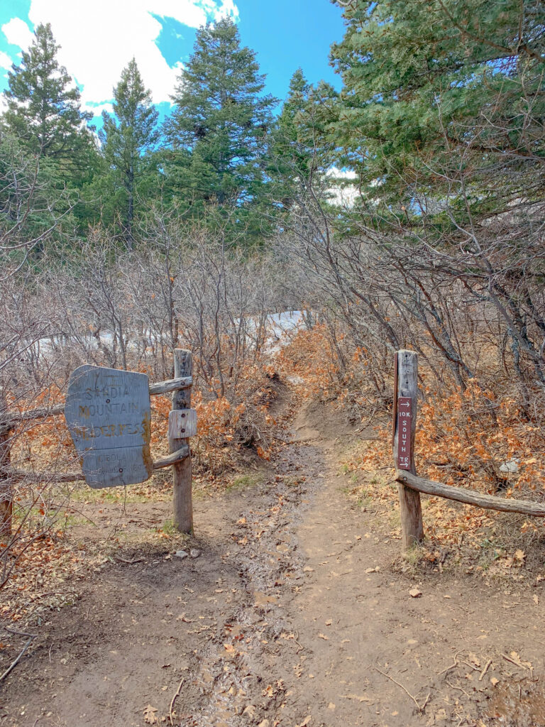
You’ll come across two trail signs along the way, both marking paths that run perpendicular to Tree Spring. In both cases, ignore the detours and keep heading straight.
The first sign you’ll see is for the Oso Corridor Trail. Continue straight and follow the main trail over the rocky stretch pictured below.
The second sign appears near the top of the trail, for the 10K Trail. Continue straight through the opening between the two fence posts, or you’ll miss the finish.
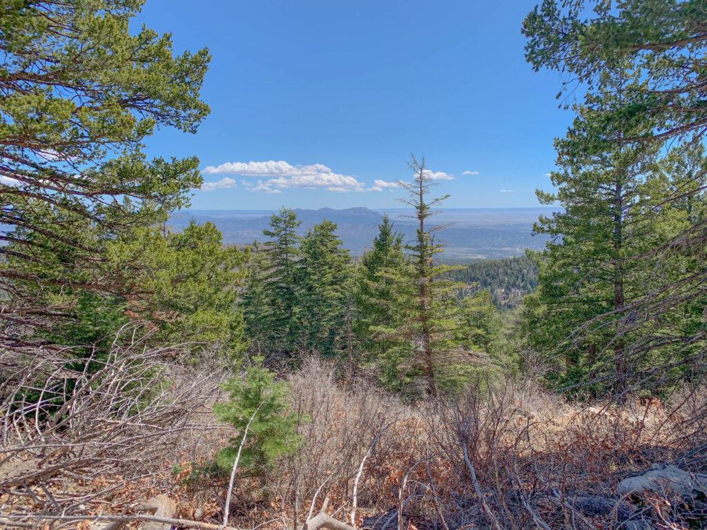
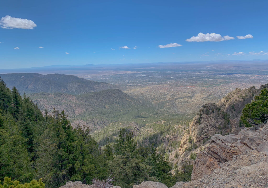
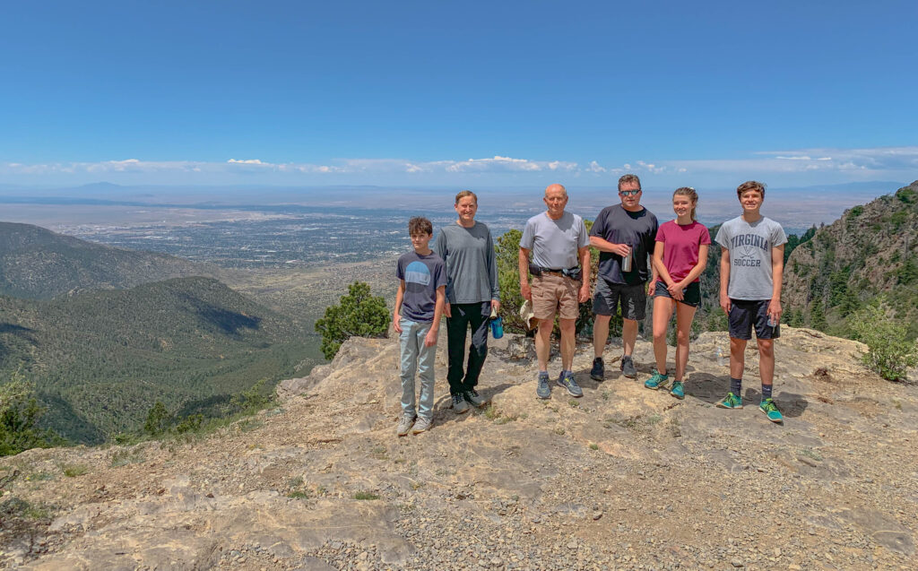
Just two miles from the trailhead, you’ll reach the saddle of Sandia Peak and be rewarded with sweeping views of Albuquerque to the west. It’s often windy up here, so this is one of those literal “hold onto your hat” moments.
Downhill: Where Your Lungs Celebrate and Your Knees File a Complaint
From the overlook, it’s a 2-mile descent back to your car, and probably a reminder that your knees aren’t quite the spring-loaded marvels they used to be. Most hikers finish the round trip in 1.5 to 2.5 hours, depending on pace, snack strategy, and how long they stare wistfully into the distance pretending they’re in a Patagonia ad. Lingering is highly encouraged.
Back in my trail-running days, I cranked out the whole thing in just over 52 minutes, not that I was keeping track or anything. (Okay, fine. It was 52:16.) These days, I stop to soak in the view, savor the silence, and enjoy the absence of email notifications. Call it mindful hiking or aging with style. Or maybe it’s just that the cell service is spotty and I can’t run like I used to. But “mindful hiking” sounds better, so let’s go with that.
Back to the Trailhead—and Maybe the Lazy Lizard
Because every hike deserves a proper ending, and by “proper,” I mean pizza, a cold drink, and a place where sweaty clothes don’t raise eyebrows. Just down the hill on NM-14, the Lazy Lizard Grill delivers all of the above, plus live music on the patio if you time it right. It’s the kind of spot where post-hike calories don’t count, and nobody cares if you still have pine needles in your hair.
Final Take: Peace, Pines, and a Bit of Elevation
If you’re looking for a short, scenic hike that’s just far enough off the beaten path to feel like an escape, without needing to train for an ultra-marathon, Tree Spring Trail is tough to beat. It’s beautiful, peaceful, and manageable for a wide range of hikers, including families and casual hikers.
So grab some dollar bills, leash the dog, and point your wheels east. The mountains are calling.
📚Want to Learn More?
If your time in the Sandia Mountains sparks a deeper interest in hiking, wildlife, or the landscapes around Albuquerque, these books are a great place to start:
Sandia Mountain Hiking Guide, Revised and Expanded Edition by Mike Coltrin. A detailed, trail-by-trail guide to the Sandias, with route descriptions, mileage, and elevation info. If you’re the type who likes to know exactly what you’re getting into before heading out, this one’s hard to beat.
Field Guide to the Sandia Mountains by Bob Julyan. A go-to guide for understanding the trails, terrain, and natural history of the Sandias. If you plan to hike here more than once, this is the one book that actually makes you feel like you know what you’re looking at.
60 Hikes Within 60 Miles: Albuquerque by David Ryan and Stephen Ausherman. A practical guide with a wide range of hikes around Albuquerque, including several in the Sandias. Great for finding new trails when you’re ready to branch out.
New Mexico’s Magnificent Sandia Mountain: The Complete Geological Story by Dirk Van Hart. A deep dive into how the Sandias were formed, written in a way that’s surprisingly readable even if you’re not a geologist. If you’ve ever looked at those ridgelines and wondered what you’re actually seeing, this book connects the dots.
Enchantment and Exploitation: The Life and Hard Times of a New Mexico Mountain Range by William deBuys. A thoughtful look at how people and landscapes interact in New Mexico. It adds depth to what you’re seeing out there, especially the balance between recreation and preservation.
Sandia: Seasons of a Mountain by David Muench and Ruth Rudner. A beautifully photographed look at the Sandias through all four seasons, paired with reflective essays. Less of a guide and more of a way to experience the place when you’re not on the trail.
Thought for the Week
For this week’s “thought for the week,” I’ll leave you with a quote that’s stuck with me ever since I first heard it, simple, clever, and true. It didn’t come from a granola-crunching wilderness guide or a fitness influencer with a GoPro. It came from George Macaulay Trevelyan, a Cambridge academic and historian from the early 1900s who made English history read like a novel.
Trevelyan (1876–1962) spent much of his life buried in books, yet he clearly understood the clarity and calm that comes from a good walk in the woods.
Trevelyan believed in the healing power of movement, of getting out of your head and into your legs. And honestly, that’s what Tree Spring Trail delivers. It’s not just about elevation gain or Instagram-worthy views, though you’ll get both. It’s about stepping away from screens, schedules, and to-do lists, and letting your “two doctors” do their work.
Whether you charge up the trail like it’s a race or take your time with plenty of snack breaks and pine-sniffing detours, you’ll come back better than you started. And that’s the kind of medicine we could all use a little more of.
“I have two doctors, my left leg and my right.”
— G.M. Trevelyan
Thanks for reading and happy travels!
Mark (The New Mexico Travel Guy)

Mark Aspelin, The New Mexico Travel Guy (www.newmexicotravelguy.com), is a travel writer, conservation biologist, project manager, and author of two books. He’s visited over 100 countries and all 50 U.S. states, just enough to land in the Travelers’ Century Club and make choosing a favorite place nearly impossible. He’s currently on a questionable mission to visit every town in New Mexico (there are over 500) and write a story about each one, with plans to wrap it up sometime before his early to mid 100s. Mark balances his writing with conservation and project work from his home base in the East Mountains near Albuquerque, New Mexico.


Leave a reply