A scenic stop packed with Navajo history, Jurassic geology, and a highly rated but little-known hiking trail—just minutes from Gallup.
If you’ve ever driven east of Gallup on Interstate 40 and noticed those towering red cliffs glowing in the afternoon light, then you’ve already had a glimpse of one of New Mexico’s most overlooked outdoor destinations: Red Rock Park. At the heart of that dramatic landscape is Church Rock—the namesake of a small Navajo community, a towering sandstone spire, and a surprisingly rewarding hiking trail that deserves a spot on your New Mexico adventure list.
I stopped at Church Rock for a short hike during a drive from Phoenix back to Albuquerque—a spontaneous detour that ended up being one of the highlights of the trip. Red Rock Park offers a blend of Jurassic-era geology and Native American cultural heritage, set against some of the most dramatic rock formations in the state.

Table of Contents
Heads up: Some of the links in this post are affiliate links. If you buy something through them, it helps support this site—at no extra cost to you. I only recommend stuff I genuinely use and trust.
Where in New Mexico Are We?
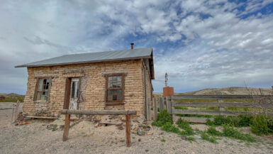
Church Rock is a census-designated place (CDP) in McKinley County, New Mexico—meaning it’s a recognized community for statistical purposes, though not an incorporated town. It’s part of the Navajo Nation and sits along Outlaw Road, a name that sounds like it came straight out of a Western. Surrounded by layered sandstone cliffs and sweeping views, Church Rock is also home to a 640-acre park that ranks among Gallup’s best spots for hiking and outdoor exploration. It’s located about 10 to 15 minutes from downtown Gallup and sits at an elevation of roughly 6,600 feet.
According to the 2020 U.S. Census, Church Rock is home to about 1,500 residents. The broader Church Rock Chapter of the Navajo Nation includes more than 2,800 people across a wider region.
Brief History of Church Rock, New Mexico
Church Rock, New Mexico may look like a quiet community along I-40, but it carries a story that runs far deeper than the passing traffic suggests. Located on the Navajo Nation and framed by towering sandstone cliffs, Church Rock has long been part of the cultural and spiritual landscape of the Diné people. The striking formation known locally as Church Rock—and officially as Navajo Church, or Tsé Íí’áhí (pronounced ts-eh ee-ee-ah-hee) in Navajo, meaning “rock church”—has stood as a landmark for generations.
By the mid-20th century, another chapter began to take shape—this one driven by the uranium boom. As Cold War fears surged and the U.S. government stockpiled nuclear material, companies set up shop across the Four Corners region. One of those was the United Nuclear Corporation (UNC), which built a uranium mill just outside of Church Rock. From 1977 to 1982, the mill processed ore from nearby mines, storing radioactive waste in a tailings pond held back by a dam that—on paper—should have worked just fine.
But on July 16, 1979, the dam failed. More than 94 million gallons of acidic, radioactive wastewater—and over 1,000 tons of solid waste—burst into the Puerco River, flowing downstream through Navajo land. While the Three Mile Island incident that same year dominated national headlines, the Church Rock uranium spill—the largest radioactive release in U.S. history—barely made the news. Many residents weren’t warned, and some unknowingly waded through the contaminated water before sunrise.
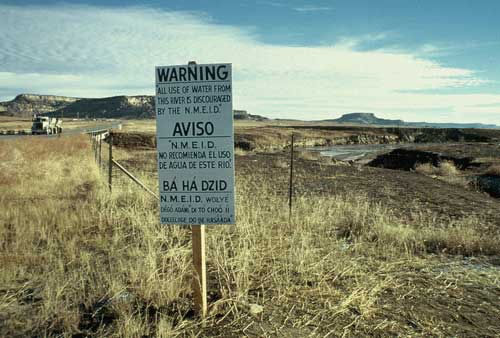
The health and environmental effects were immediate and long-lasting. Livestock sickened. Wells were contaminated. Families who relied on the Puerco River for daily use found themselves without answers or support. In the decades since, the site has been added to the EPA’s list of Superfund cleanup locations, and community-led efforts like the Church Rock Uranium Monitoring Project have stepped in to monitor contamination and push for accountability. In 2005, the Navajo Nation banned uranium mining across its lands, though debates around economic development and environmental risk continue today.
In more recent years, the Church Rock community has also focused on cultural restoration. Since 2010, the Church Rock has hosted the annual Treaty Day Festival on June 1, marking the signing of the Treaty of 1868 between the Navajo Nation and the U.S. government. That treaty ended the forced relocation of the Navajo people to Fort Sumner (Bosque Redondo) and allowed them to return to their ancestral lands. The festival is a celebration of endurance and sovereignty—offering space for reflection, pride, and community connection.
Church Rock is many things—a geologic landmark, a Navajo community, and the site of a major environmental tragedy. But most of all, it’s a place of resilience. The story here isn’t just about what happened in the past—it’s about what continues: the long push for cleanup, the preservation of culture, and the strength of a community that keeps moving forward. Visitors to Red Rock Park may come for the scenery—but the real story of this landscape runs much deeper than the sandstone.
📖 If you’re curious to dive deeper into the life, culture, and complexity of Gallup and the surrounding area, I recommend the book A Place of Thin Veil: Life and Death in Gallup, New Mexico by Bob Rosebrough (2022). It’s a thoughtful and compelling read by a longtime local.
Red Rock Park: What You’ll Find
While you might see it referred to as Red Rock State Park, it’s not part of the New Mexico State Parks system. Red Rock Park is a municipal park, jointly managed by the City of Gallup and McKinley County. You won’t find it on any official state park list—but what it lacks in state-level branding, it more than makes up for in scenery and substance.
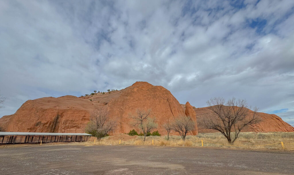
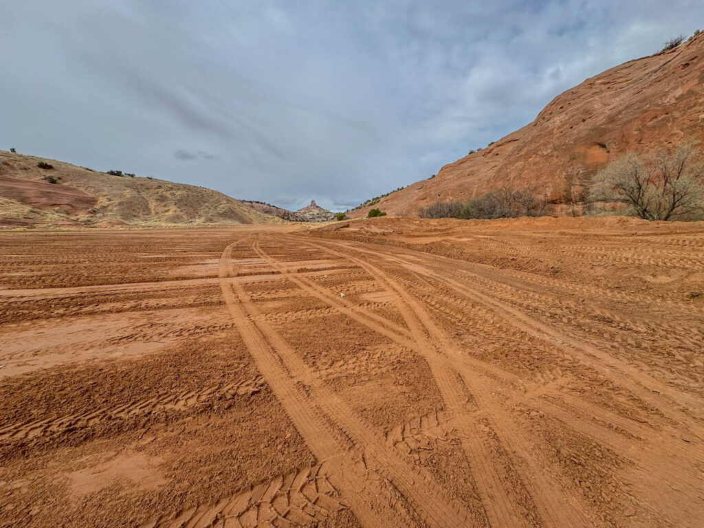
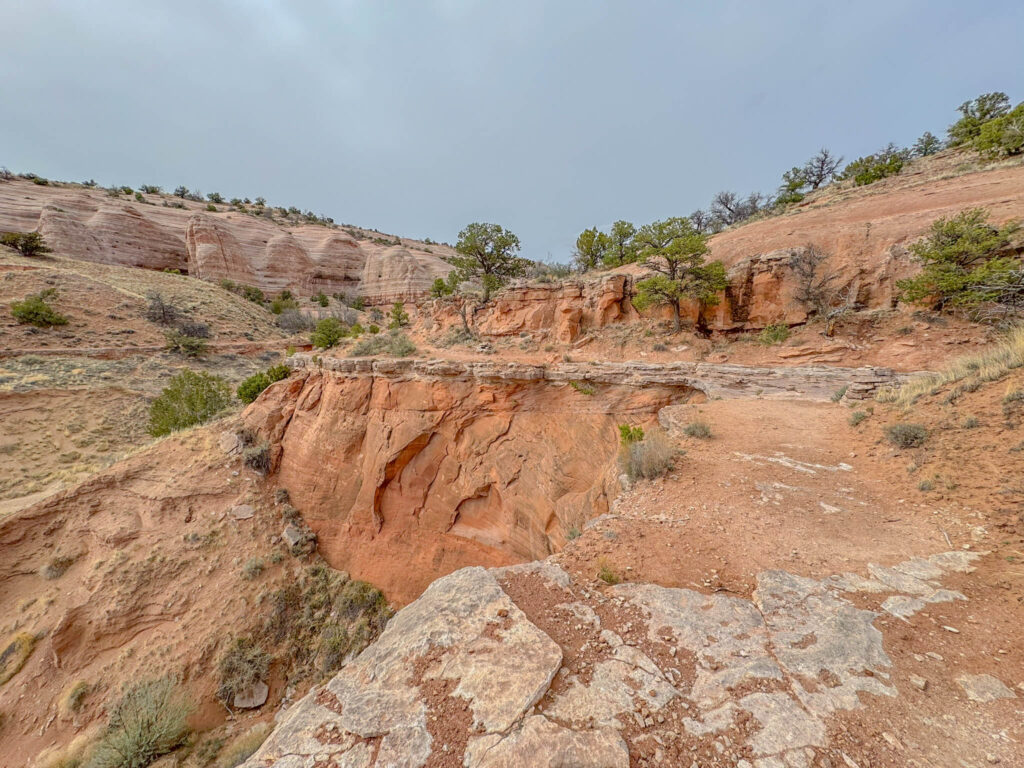
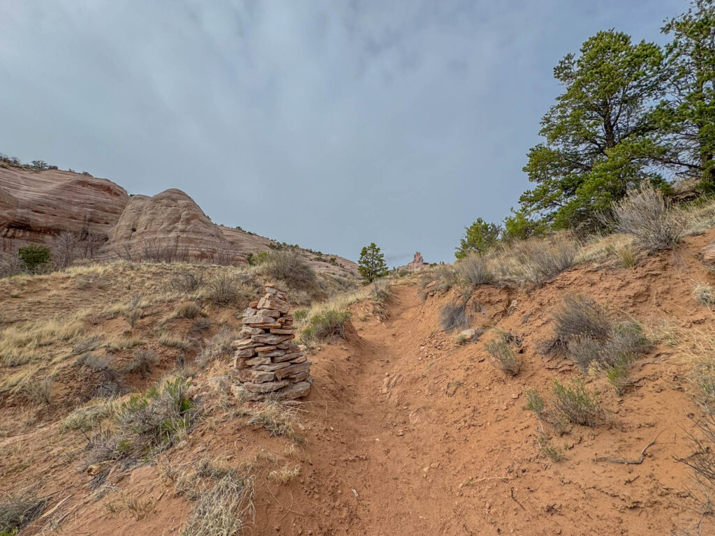
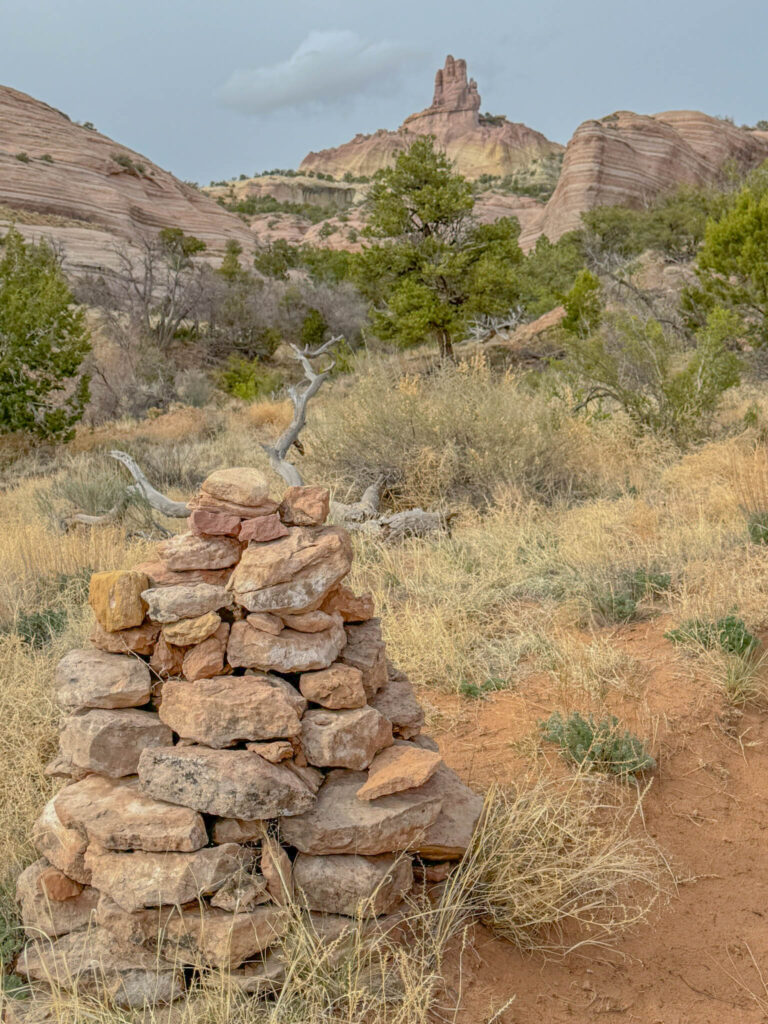
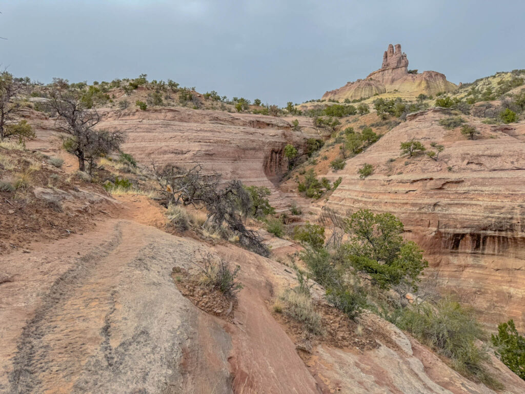
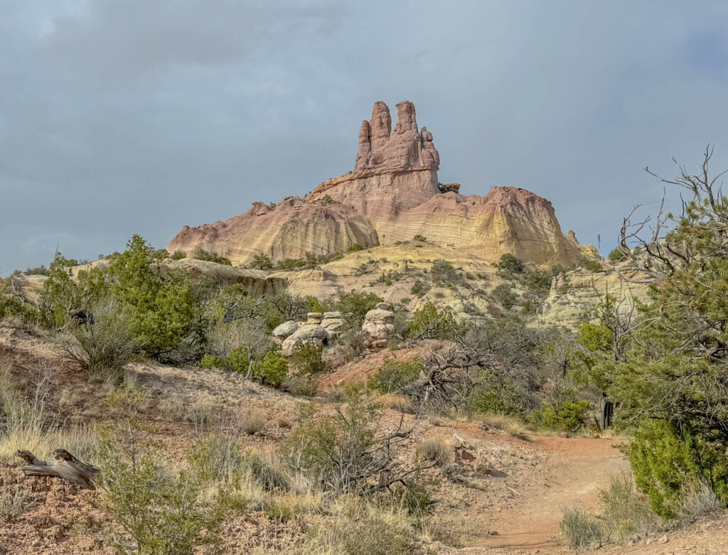
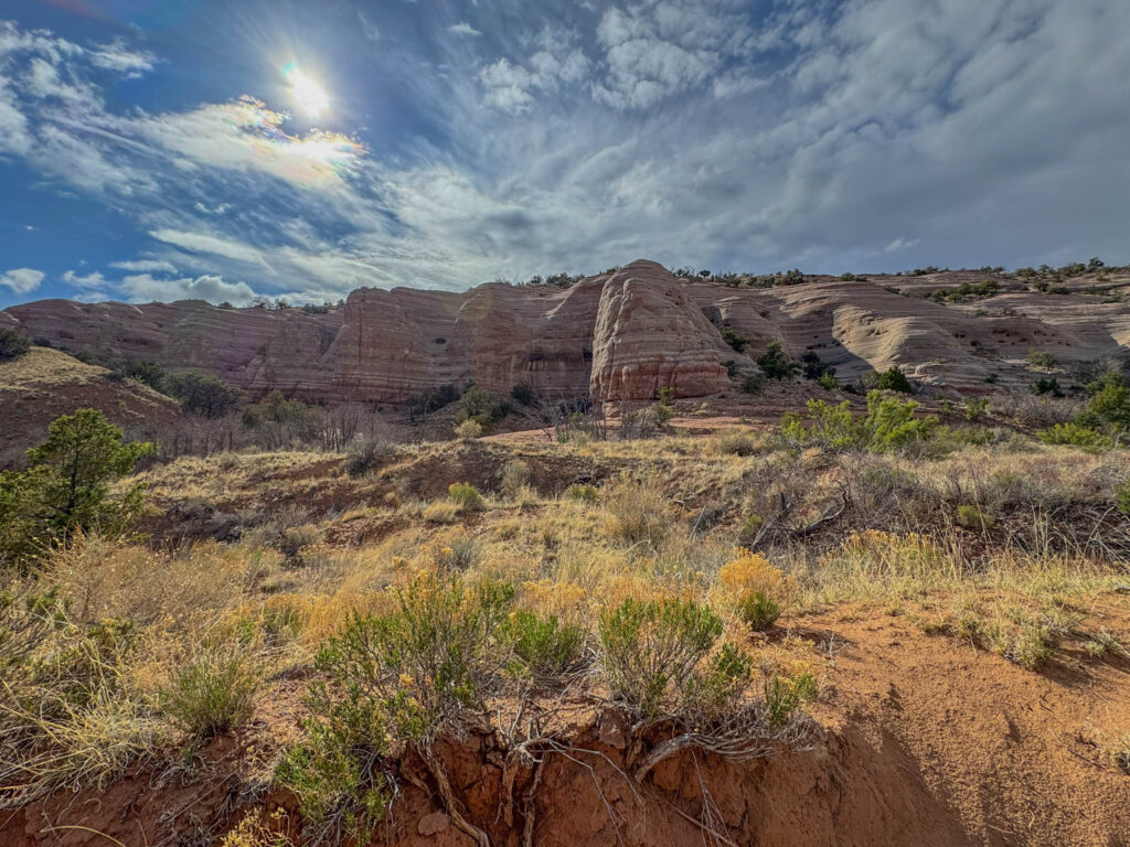
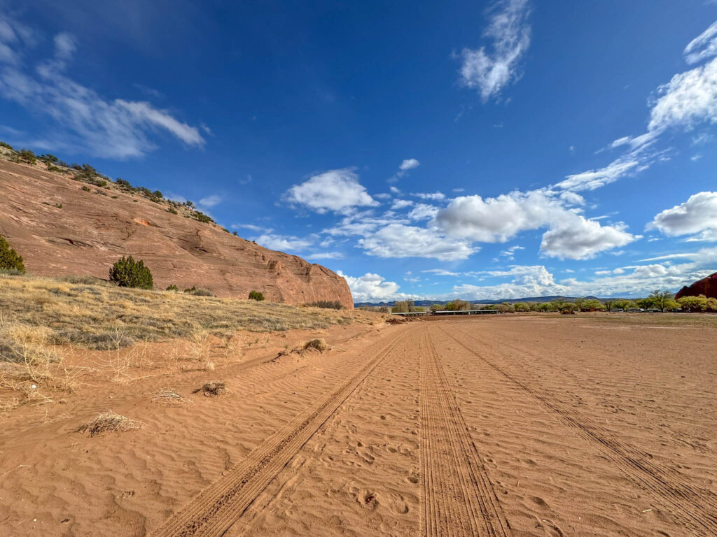
The park is home to high ridges, spectacular red cliffs, and ancient sand dunes hardened into stone. It sits at the base of Navajo Church, aka Church Rock. With its towering spires and layered sandstone, the formation rises like a cathedral from the high desert floor and has become the signature landmark of Red Rock Park.
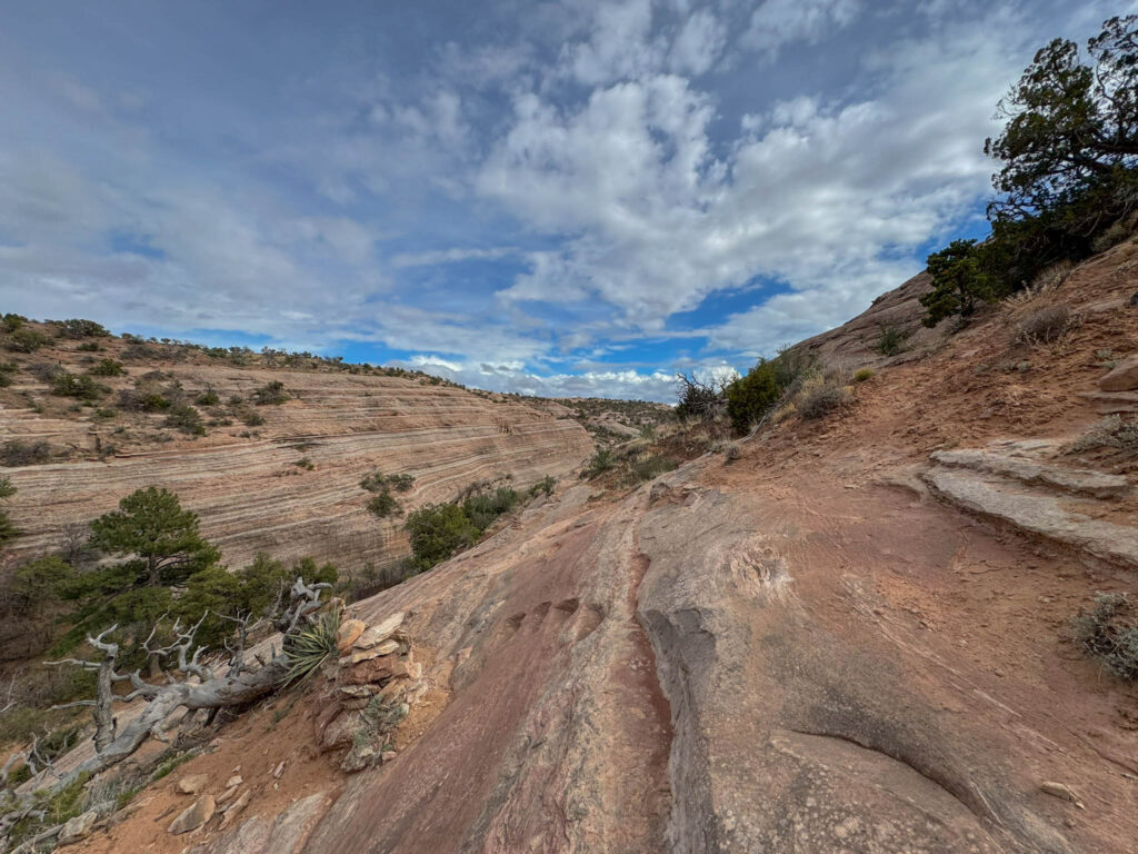
The reddish-orange silty layers, yellow sandstone bands, and rounded rock formations here aren’t just photogenic—they’re part of a geologic story that goes back to the Jurassic period. Specifically, this area showcases two major formations: Entrada Sandstone and the Morrison Formation. The Entrada Sandstone, responsible for the park’s distinctive red cliffs, formed roughly 160 million years ago from windblown sand dunes and tidal flats—similar to what you’d see in parts of southern Utah today. Just above that lies the Morrison Formation, a rock layer famous for containing some of the richest dinosaur fossil beds in North America. While you won’t find fossils sticking out of the rock here, these formations offer clues about a time when this region was home to rivers, floodplains, and giant prehistoric creatures.
Red Rock Park takes its name from the surrounding formations, but it offers more than just a scenic backdrop. As a community-run park, Red Rock Park facilities include:
- Picnic Areas: Scattered throughout the park, these areas offer on-site restrooms and are great for a quick lunch or a shaded break.
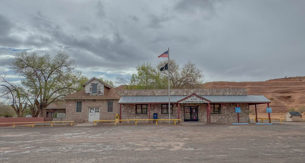
- Campgrounds (Main and West): Red Rock Campground features two campgrounds that provide electric and water hookups, along with bathrooms and showers. The Main Campground also features a small post office. Reservations are required; for more information, the office phone number is (505) 722-3839 or you can email a staff member at rrpadmin@gallupnm.gov.
- Camp Store: Located near the campgrounds, the store offers basic supplies for campers and hikers.
- Red Rock Park Museum: Located next to the Red Rock Park Convention Center, the Red Rock Museum highlights the history and cultural traditions of the Zuni, Hopi, and Navajo peoples. Exhibits include jewelry, pottery, rugs, and other Native American art, along with displays tracing the region’s cultural timeline from the Ancestral Puebloans (300–1200 CE) to the present day.
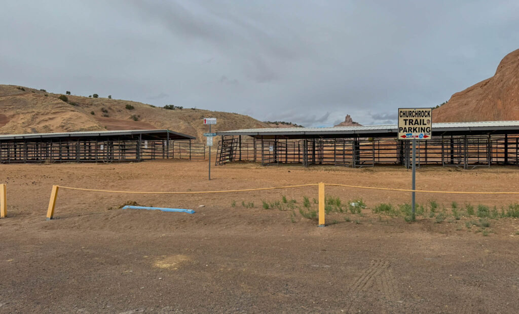
- Rodeo Arena: This outdoor venue seats up to 5,000 people and hosts a range of events, including rodeos, Arenacross (indoor-style motocross racing on a dirt track with jumps and tight turns), and Native American dance showcases. Just behind it is the Butler Jackpot Arena, a smaller venue used for team roping and other rodeo events, including jackpot-style competitions during the annual Gallup Inter-Tribal Ceremonial. Horse stalls are also available for rental.
- Red Rock Park Convention Center: Located on the west side of the park, the center offers meeting and dining facilities suitable for events and gatherings.
- Park Office: Open Monday through Friday from 8:00 a.m. to 4:00 p.m., the office provides maps and information about the park.
Whether you’re into hiking, geology, local culture, or just looking to stretch your legs during a road trip (like I did), Red Rock Park is worth the stop.

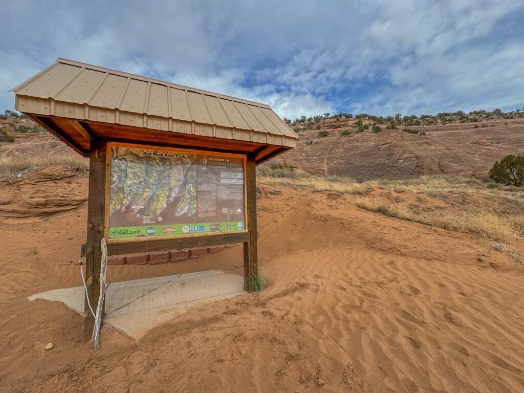
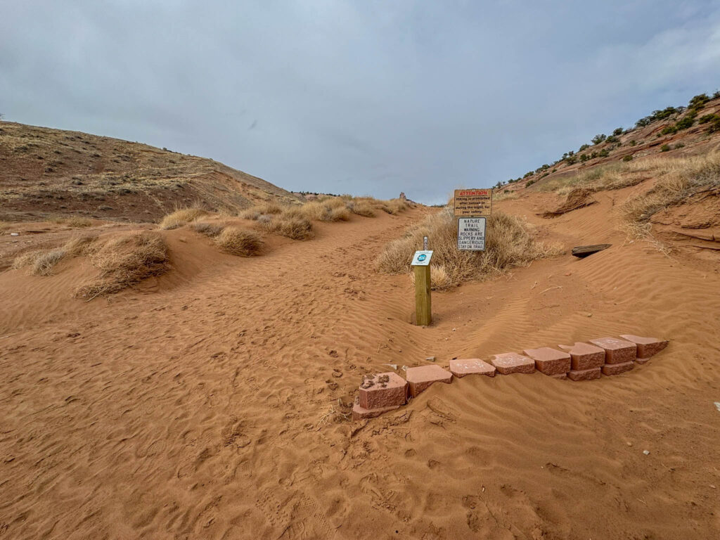
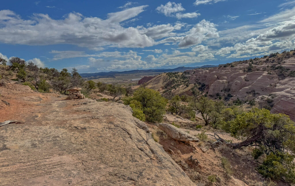
The Church Rock Trail: Overview and Highlights
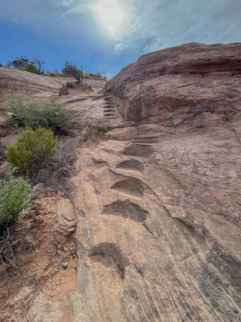
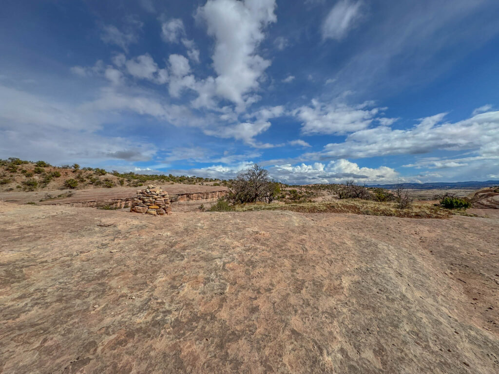
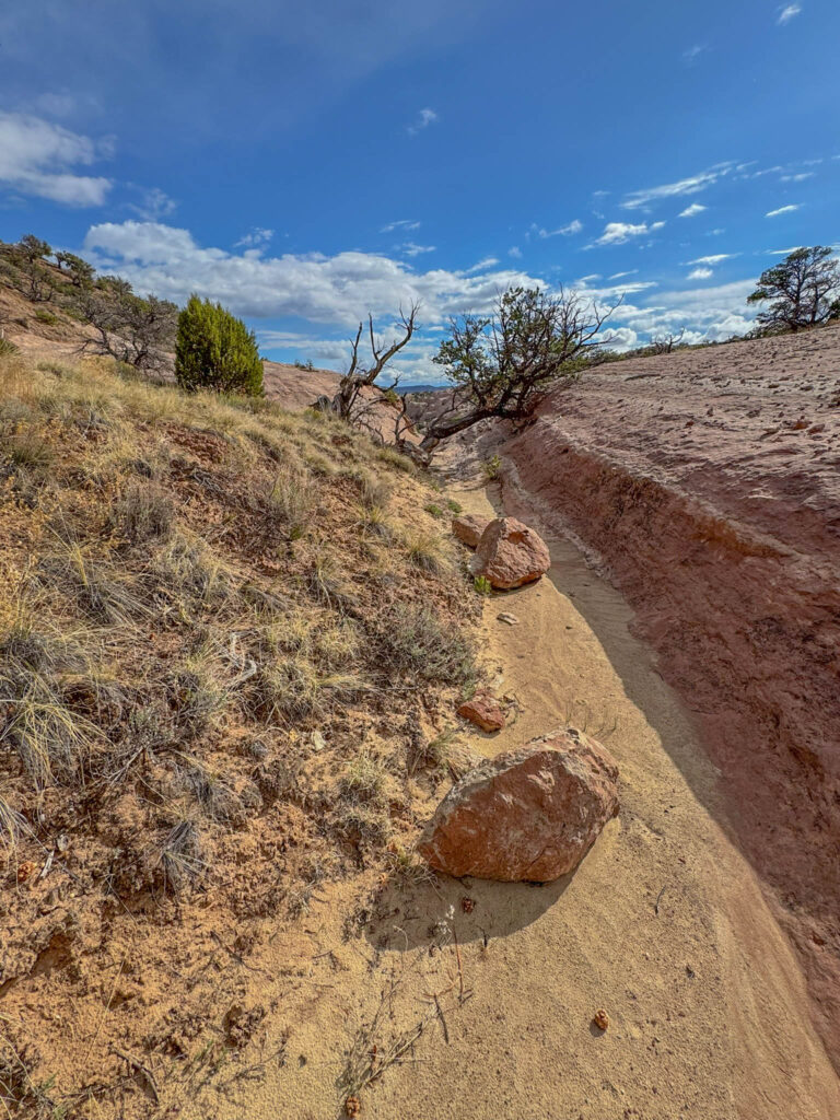
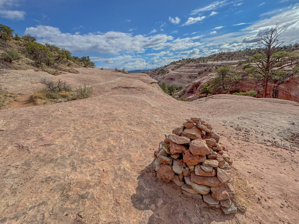
Starting from the east side of the Red Rock Park Campground, the Church Rock Trail is a 2.2-mile out-and-back route with a short loop section. It’s listed as moderate on AllTrails, mainly due to some rocky stretches and brief, steep scrambles—but I’d say it’s on the easier end of moderate. Take your time, wear good hiking shoes, and most people will find it both manageable and rewarding.
The trail gains just under 300 feet of elevation, so while there’s a bit of climbing, there aren’t any serious hills to contend with. The trickiest sections are on the slickrock, where the footing can get uneven or slippery—especially after rain. Depending on your pace (and how often you stop to take photos… which, in my case, was often), plan on spending 1 to 2 hours on the trail.
If you’re looking for a longer outing, you can tack on the nearby Pyramid Rock Trail, which links into a larger loop network within Red Rock Park.
Here’s a link to Church Rock Trail on AllTrails in case you want to check recent reviews, trail conditions, or download a map.
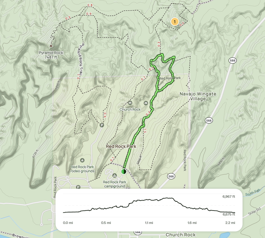
Church Rock Trail Stats and Tips
- Distance: 2.2 miles round trip
- Elevation Gain: ~255 feet
- Time: 1–2 hours, depending on pace and photo/snack breaks
- Trailhead: Near the east end of the main campground
- Restrooms: Available near picnic areas and the Red Rock Park Office
- Difficulty: Moderate—mostly due to rocky sections and a few short, steep scrambles
- Best Time to Visit: Fall or spring; summers can be hot, and winter winds can be brutal
- Pro Tips:
- Safety: Red Rock Park is generally safe, but it’s best to lock your car and keep valuables out of sight—standard advice for any well-traveled hiking spot.
- Download a trail map in advance. While cell service is decent in most areas, you may hit a few dead zones along the way. I use AllTrails+ to download maps and access them offline—it’s been a game-changer for staying on track in remote spots.
What You’ll See
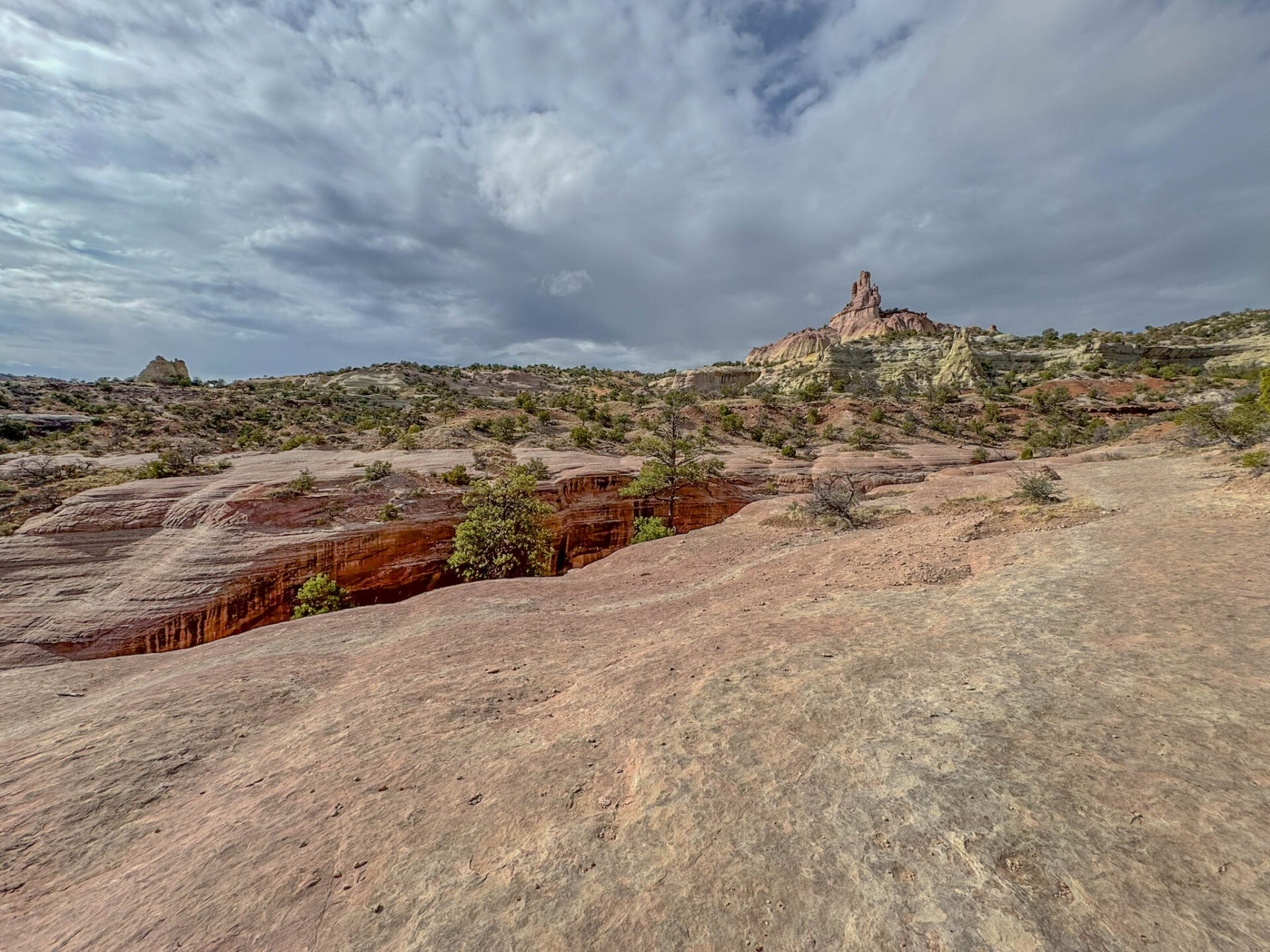
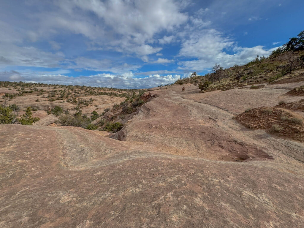
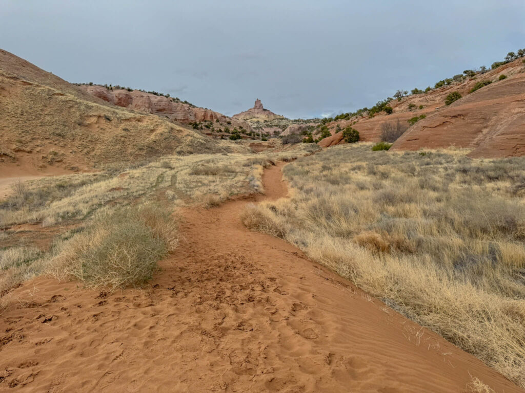
As you climb, you’ll make your way through layers of brick-red siltstone, thin sandstone bands, and the occasional outcrop of orange rock—classic markers of this ancient Jurassic landscape. The trail eventually brings you to the base of Church Rock itself. From the high point, you’ll get a wide-angle view of the cliffs and mesas that define this part of New Mexico.
You might spot a few lizards sunning themselves, a raptor riding the thermals, or just a whole lot of wind-carved stone. But rather than try to describe every detail, I’ll walk you through the hike in photos—so here goes.
Here’s a quick video to give you a wider look at the landscape from this point along the trail.

Final Thoughts: Why Church Rock Deserves a Visit
New Mexico has its share of headline attractions—White Sands, Carlsbad Caverns, Bandelier—but Church Rock? This isn’t a place you typically stumble upon unless you’re looking for it.
If you’re someone who leans toward silence and sandstone over noise and neon—then Church Rock should be on your radar.
The Church Rock Trail is a walk through millions of years of sedimentary storytelling, set against the kind of backdrop that makes you stop, breathe deep, and remember why you love this state.
Want to hike it yourself? Pack water, good shoes, and a sense of wonder. Church Rock is waiting.
Thought for the Week
For this week’s edition of the “Thought for the Week,” I went with a theme of listening—to the land, to the quiet, and to whatever else might rise to the surface when things slow down. It felt like a good fit after hiking Church Rock Trail. There’s something about walking through ancient sandstone and towering cliffs that shifts your attention. Not just outward (though I did take far too many photos), but inward too.
I often listen to a podcast or audiobook while exercising, but these days, I’m making a point of not bringing any headphones with me when I hike. That felt especially true at Church Rock—it just didn’t seem like the kind of place for background noise.
That’s why this week’s quote comes from the Navajo people who live at Church Rock. It’s a reminder that the land has something to say—if we’re paying attention.
Whether you’re out on a trail or just trying to cut through the noise of everyday life, I hope you find a moment to be still—and listen.
“Be still and the earth will speak to you.”
— Navajo Proverb
Thanks for reading and happy travels!
Mark (The New Mexico Travel Guy)
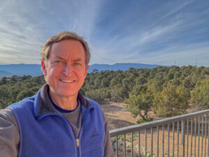
Mark Aspelin, The New Mexico Travel Guy (www.newmexicotravelguy.com), is a travel writer, conservation biologist, project manager, and author of two books. He’s visited over 100 countries and all 50 U.S. states—just enough to land in the Travelers’ Century Club and make choosing a favorite place nearly impossible. He’s currently on a questionable mission to visit every town in New Mexico (there are over 500) and write a story about each one, with plans to wrap it up sometime before his early to mid 100s. Mark balances his writing with conservation and project work from his home base in the East Mountains near Albuquerque, New Mexico.


Leave a reply